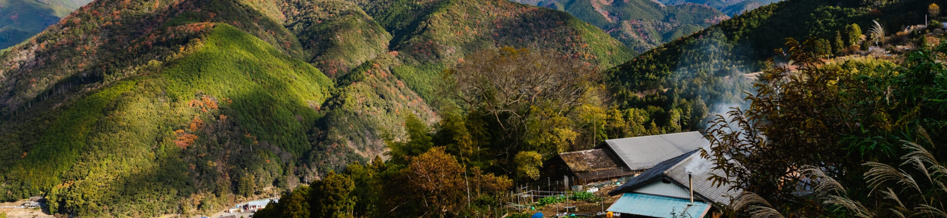
Kumano Kodo: 6 Beginner-Friendly Walking Routes You Can Do in About 3 Hours
In this guide, we introduce six beginner-friendly hiking routes for your first visit to the Kumano Kodo. Spanning Wakayama, Mie, and Nara prefectures, the Kumano Kodo is a long-distance pilgrimage network with many route options. From that network, we’ve curated routes that are ideal for first-time visitors and novice hikers.
How hard are the climbs? How far is each route, and how long will it take? What kind of scenery can you expect? We answer all of these questions—and share packing and gear tips for your first Kumano Kodo walk.
Where is the Kumano Kodo located? Can you visit it on a day trip?
The Kumano Kodo is a network of ancient pilgrimage routes leading to the Kumano Sanzan—the three grand shrines of Kumano Hayatama Taisha, Kumano Nachi Taisha, and Kumano Hongu Taisha—in Wakayama Prefecture. Stretching over 600 km, the trails were inscribed on the UNESCO World Heritage List in 2004. Much of the historic shrine culture and pristine nature remains today, and many visitors are drawn to its quiet, spiritual atmosphere—some even say their visit became a life-changing retreat.
The Kumano region is relatively remote—sometimes nicknamed a “land island” in Japan—so access can feel limited. Even so, it’s about 1.5–2 hours from the Kansai area (e.g., Osaka), and around one hour from Tokyo if you fly from Haneda to Nanki-Shirahama Airport, which brings you close to several trailheads. If you focus on a few key spots, a day trip is doable.
If walking the entire network feels daunting but you still want a taste of the pilgrimage, try one of our beginner-friendly model routes and experience the Kumano Kodo at your own pace.
Beginner-Friendly Kumano Kodo Trails You Can Do in a Short Time
The Kumano Kodo is commonly grouped into five main routes:
- Nakahechi — The primary pilgrimage route from Tanabe inland through Hongu toward Nachi/Shingu.
- Iseji — Links the Ise Grand Shrine (Ise Jingu) with the Kumano Sanzan.
- Kohechi — The shortest yet most demanding route connecting Koyasan (Mt. Koya) with Kumano Hongu Taisha.
- Kii-ji (Kiiji) — Runs from Kyoto via Osaka down to the Kumano Sanzan.
- Ohechi — Follows the Pacific coast southward, with viewpoints overlooking the sea.
In this article, we highlight six sections on the Nakahechi and Kohechi that take about 2–3 hours to walk and feature minimal elevation change—ideal for beginners.
Recommended Route 1 (Nakahechi): Daimon-zaka to Kumano Nachi Taisha & Nachi Falls
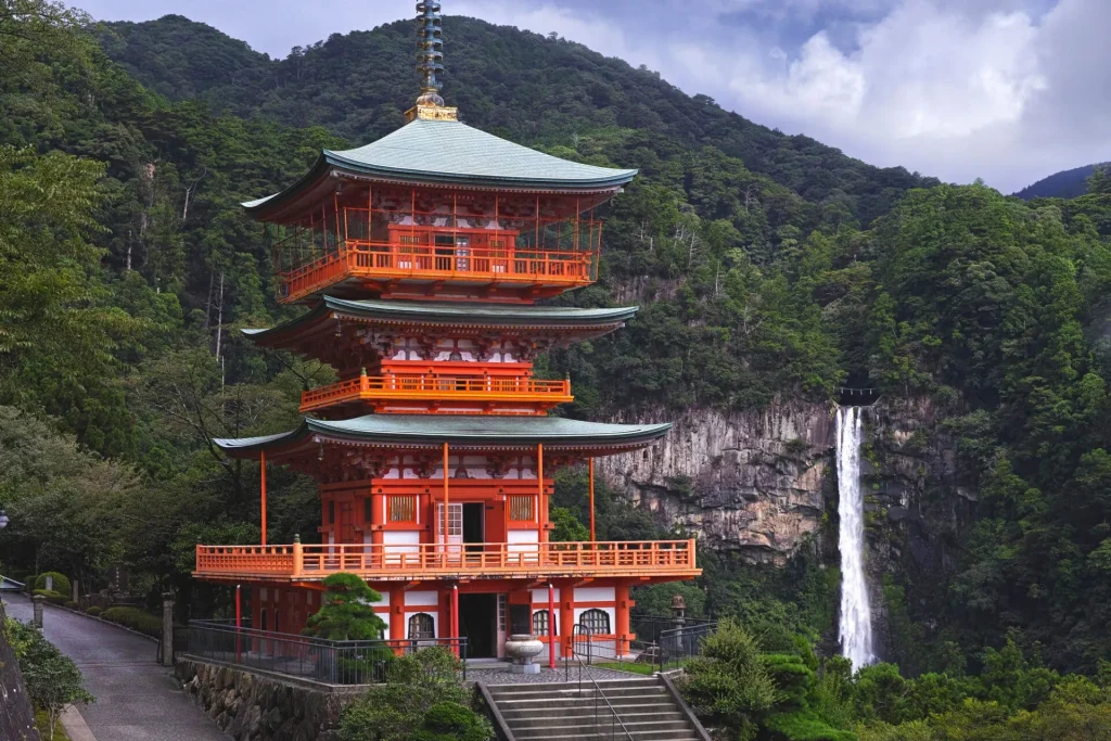
Our first recommendation is the route from Daimon-zaka to Kumano Nachi Taisha, which takes about an hour on foot.
You’ll walk a classic stretch of the Kumano Kodo through lush forest and then visit Nachi Falls, the most iconic sight of the Kumano Sanzan.
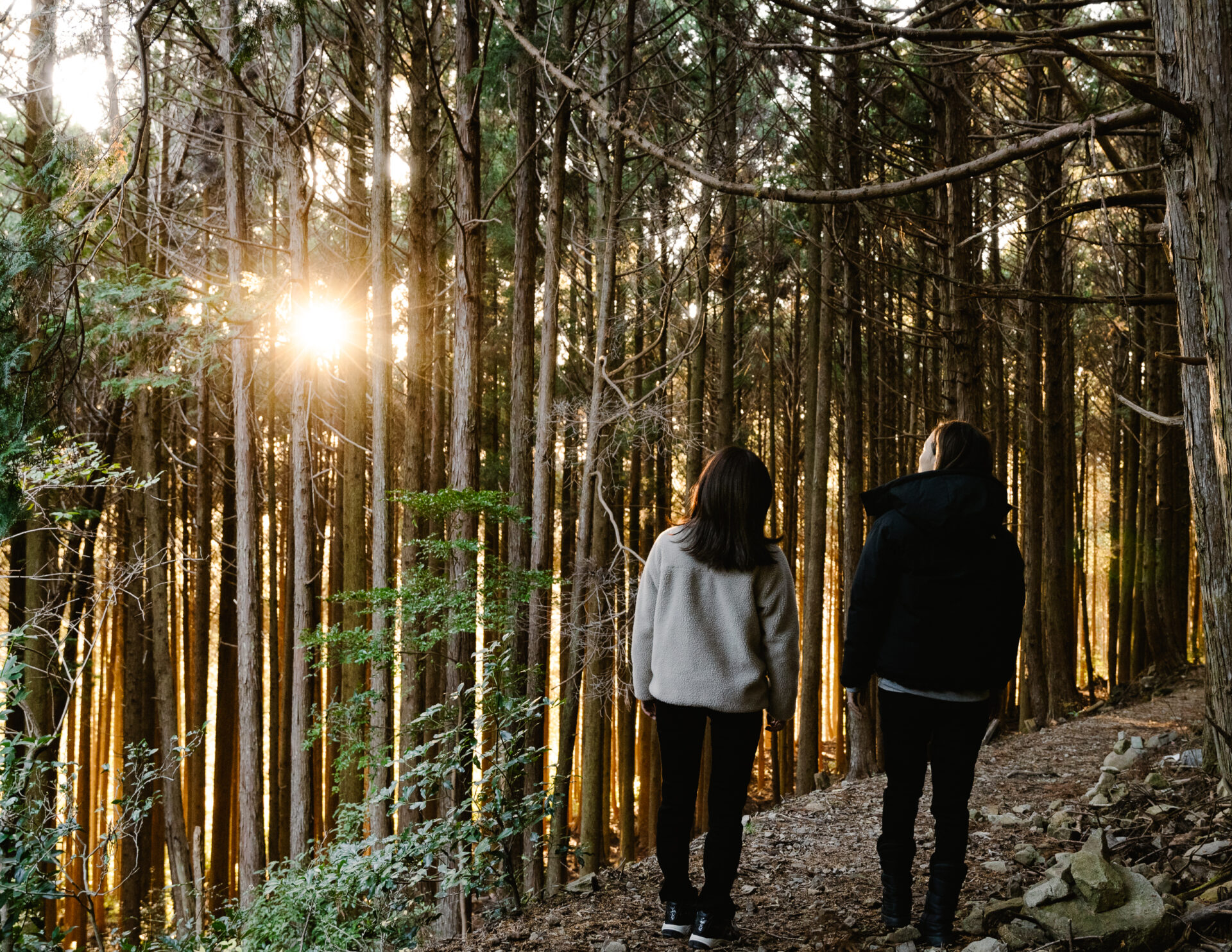
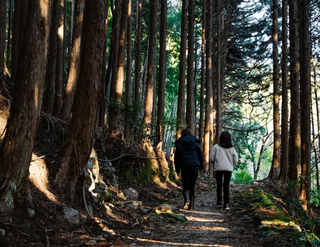
Daimon-zaka is a stone-paved slope: from the trailhead it’s an uphill walk of about 1.3 km (≈40 minutes) with an elevation gain of roughly 100 m. The moss-covered path and towering cedars create a calm, meditative atmosphere.
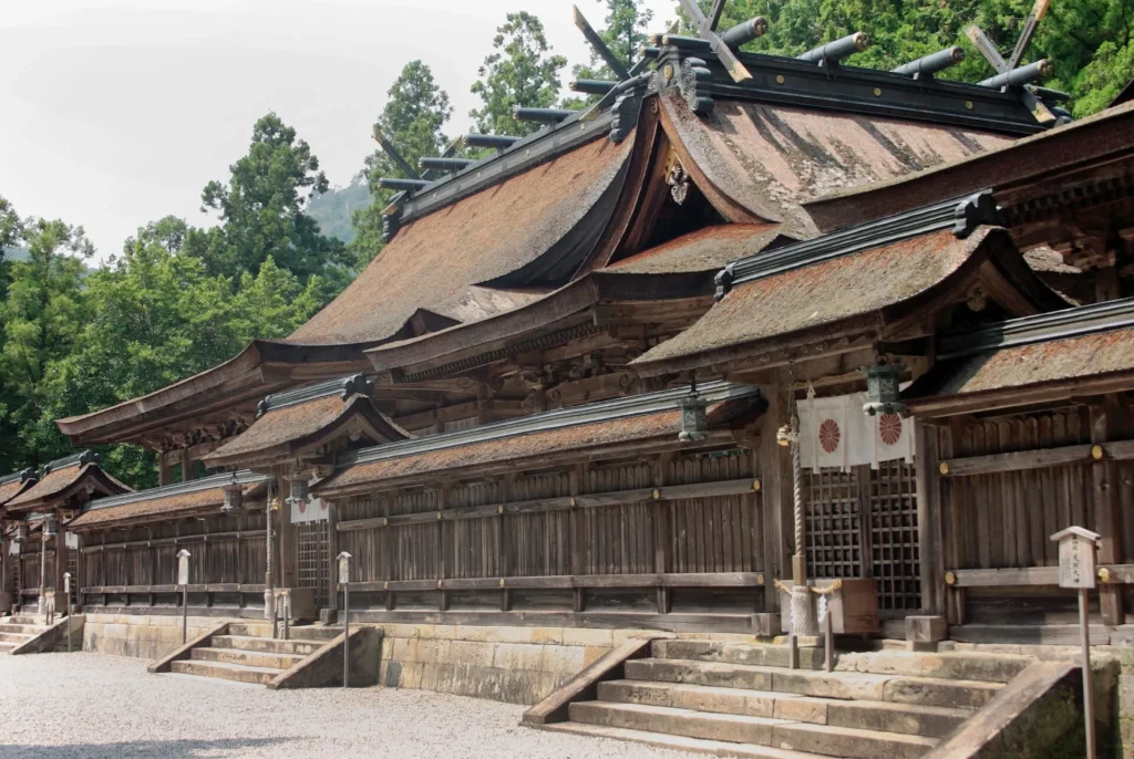
At the top, you reach the vermilion buildings of Kumano Nachi Taisha. After paying your respects, follow the path through a bamboo grove and down stone steps to Nachi Falls—one of Japan’s Three Great Waterfalls and the country’s tallest single-drop waterfall (133 m)—a truly awe-inspiring sight.
Access: The Daimon-zaka trailhead has free parking and a bus stop, making it convenient whether you come by car or public transport.
Required Time
About 1 hour
Distance
About 2.7km
Level of Difficulty
★☆☆☆☆
Recommended Route 2 (Nakahechi): Dainichi-goe to Yunomine Onsen
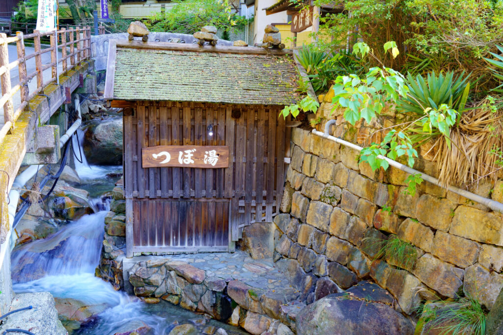
Dainichi-goe, also on the Nakahechi, is a great short option for beginners. The climb is a bit steep, so allow extra time in your plan. The highlight is finishing at Yunomine Onsen, where you can soak at Tsuboyu—a UNESCO-listed hot spring bath—and even make soft-boiled eggs in the hot spring water at the “Yuzutsu” cooking spot.
The Dainichi-goe route links Kumano Hongu Taisha and Yunomine Onsen with an elevation gain of about 240 m. First, walk to Oyunohara (about 10 minutes from Hongu Taisha), the former site of the shrine, marked by Japan’s tallest grand torii gate. After passing through the gate, head down the national highway to the Dainichi-goe trailhead.
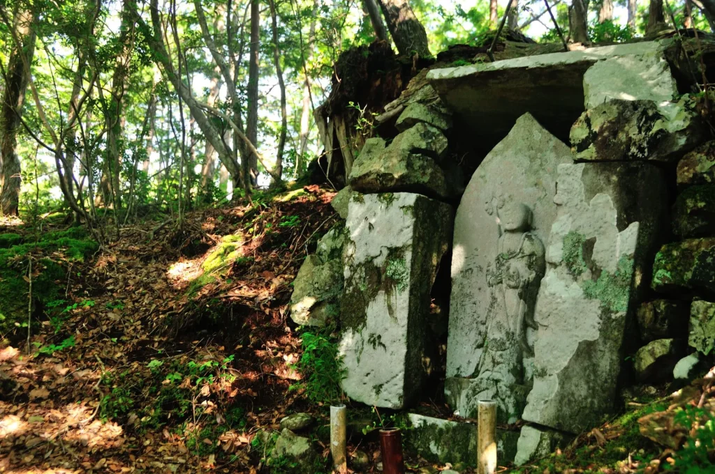
Soon after you start climbing, you’ll come to the small Tsukimigaoka Shrine tucked in deep forest—straight out of a fairytale. About 10 minutes further is the Hanakake Jizō, and after around 20 minutes of descent you’ll reach Yunomine Ōji. Once you see its torii gate, Yunomine Onsen is just ahead.
Access tips: If you’re driving, park at Yunomine Onsen (the finish) and take a bus back to Kumano Hongu Taisha to start the hike. If using public transport, take a bus to Hongu Taisha and hike toward Yunomine.
Required Time
About 2 hours
距離
About 3.7km(2km for Dainichi-goe)
Level of Difficulty
★★☆☆☆
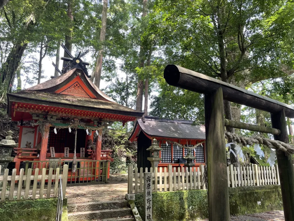
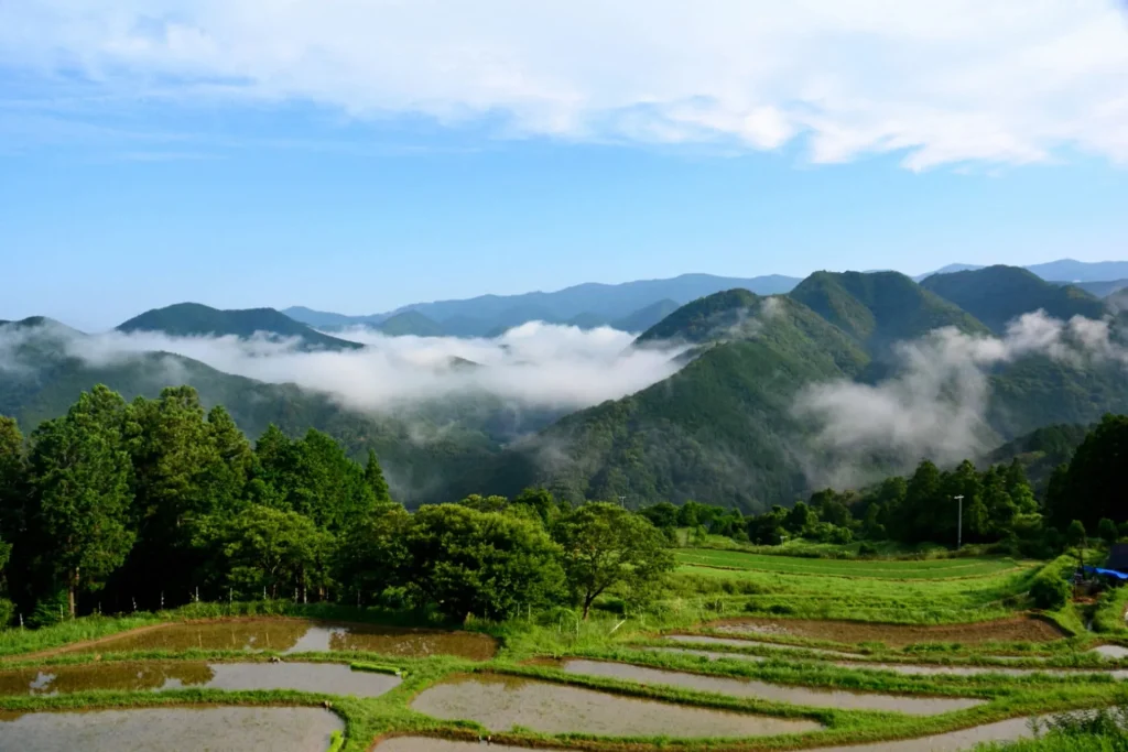
Recommended Route 3 (Nakahechi): Takijiri-oji to Takahara / Takahara Kumano Shrine
This next route is a little more challenging, but it rewards hikers with the chance to see a sea of clouds.
The starting point is Takijiri-oji (bus stop: Takijiri). There is also a parking lot if you are arriving by car. At the confluence of the Tonda River and Ishiburi River, Takijiri-oji has long been regarded as the entrance to the sacred area of the Kumano Sanzan.
Right after the start you’ll face a steep climb, but along the way are several highlights: Tainai-kuguri (a rock passage you can crawl through), Chichi-iwa (the “Breast-shaped Rock”), Fuse-oji Shrine, and the Tsuruginoyama Kyōzuka Mound.
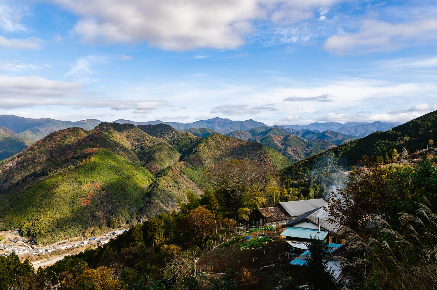
From Tsuruginoyama, the path levels out. After about 25 minutes you’ll join the road to Takahara, and another 15 minutes of steps brings you into the village of Takahara. A short walk along the road leads to Takahara Kumano Shrine, said to be the oldest shrine building along the Nakahechi. Records note that the poet Fujiwara no Teika once stopped here.
Continue a little further to Takahara Kiri-no-Sato (“Fog Village”), a viewpoint famous for its sea of clouds. The best time to catch this spectacle is in autumn to winter, especially within an hour after sunrise when there’s high humidity, calm winds, and a large difference between day and night temperatures. Even in daytime, the views are beautiful.
If you’re visiting Takahara, consider spending a night at SEN.RETREAT TAKAHARA. Unwind in quiet surroundings where only the sounds of nature break the silence.
Required Time
About 3 hours
Distance
About 3.5km
Level of Difficulty
★★★☆☆
Recommended Route 4 (Nakahechi): Sangen-jaya to Kumano Hongu Taisha
The starting point, Sangen-jaya (the junction of the Nakahechi and Kohechi), gets its name from the three teahouses that once stood here. Today you’ll find a rest pavilion built in that style. From here, follow about 2 km of old pilgrimage trail. It’s mostly a gentle descent, making for an easy walk.
Along the way, it’s worth detouring to a viewpoint that was selected among Wakayama’s “Top 100 Sunset Spots.” From here you can even look down on the giant torii at Oyunohara.
A short walk farther brings you to the Haraidono Ishizuka Site, where pilgrims once purified themselves and prayed for a safe journey. Closer to the finish is Haraido-oji, a small grove with two oaks said to be over 300 years old and a stone wayside shrine. Continue on and you’ll come out behind Kumano Hongu Taisha—walk around to enter through the main approach.
Access:
If you’re driving, park at Kumano Hongu Taisha (the finish) and take a bus to Hiraiwakuchi (also written Hiraiwa-guchi), then walk 10–15 minutes to Sangen-jaya. The same bus stop works if you’re coming by public transport.
Required Time
About 1 hour
Distance
About4km
Level of Difficulty
★☆☆☆☆
Recommended Route 5 (Nakahechi): Akagi-goe
If you’d like a slightly longer hike, try the Akagi-goe route, about 7 km from near Funatama Jinja Shrine to Yunomine Onsen.
From the Hosshinmon-oji bus stop, walk downhill for about 5 minutes to reach a forest road. Head toward the Nakahechi trail until you come to the Akagi-goe junction. Follow the sign marked 「赤木越へ」(To Akagi-goe) and begin a steep zigzag climb with stairs—about 30 minutes of effort. Once past this section, the rest of the trail is gentle and easy to walk.
After roughly an hour, you’ll reach the Nabewari Jizō statue. Another 20 minutes brings you to the Kakihara Chaya-ato (former teahouse site), a junction where several paths branch off. Check your map here and take the trail toward Yunomine Onsen.
As you approach the goal, the path descends steeply. Be careful, especially when the ground is muddy. The exit of Akagi-goe comes out right beside Tsuboyu, the small bath at Yunomine Onsen that is listed as a UNESCO World Heritage Site.
Access:
If driving, park at Yunomine Onsen or Kumano Hongu Taisha, then take a bus to Hosshinmon-oji to start your hike. You can also hike the route in reverse, beginning from Yunomine Onsen.
Required Time
About 3~4 hours
Distance
About 7.1km
Level of Difficulty
★★☆☆☆
Recommended Route 6 (Kohechi): Nyonin-michi — Koyasan Women’s Pilgrimage Loop
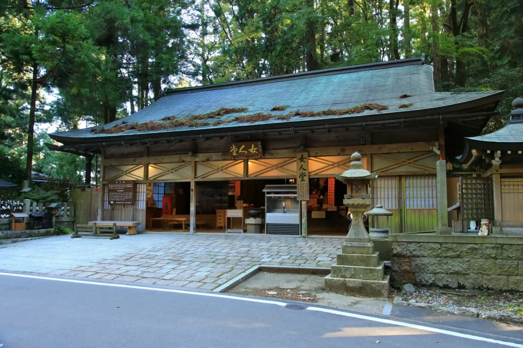
Since women were once prohibited from entering Koyasan, they instead walked the Nyonin-michi (“Women’s Pilgrimage Path”) to worship at the Nyonin-dō halls located at each of the seven traditional entrances (Kōya-nanakuchi). Today, only the Fudō-zaka-guchi Nyonin-dō survives in its original form, while the others remain as historic sites. This route invites you to retrace that history while enjoying the natural scenery.
Koyasan is encircled by mountains at an altitude of about 1,000 m, and walking the Nyonin-michi lets you summit several of them. To complete the full loop is about 17 km, starting and ending at the Fudō-zaka-guchi Nyonin-dō, but here we introduce a shorter section.
This hike begins at Fudō-zaka-guchi, follows the Nyonin-michi, and exits at Ichinohashi. Along the way you’ll see wooden waymarkers numbered along the trail (“Nyonin-michi No. X”), making navigation easy. Though over 10 km, the path is relatively flat with few steep sections.
If coming by car, park at the Koyasan Forest Park and walk to the Fudō-zaka-guchi Nyonin-dō bus stop. The trailhead can be tricky to spot as it lies between houses, marked by a torii gate. The first highlight is the Fudō-zaka-guchi Nyonin-dō, across from which stands the large Otake Jizō statue.
Next, climb Benten-dake (984 m). Though steep, handrails are in place to assist you. At the summit you’ll find the striking red torii of Dake-no-Benzaiten-sha Shrine, along with panoramic views—an excellent rest spot.
Descending from there, the path passes the remains of several Nyonin-dō sites (Daimon-guchi, Ryujin-guchi, Otaki-guchi, Omine-guchi), as well as Rokuro Pass, before joining the Kohechi, one of the main Kumano Kodo routes. Finally, you reach Okunoin, the sacred cemetery filled with towering cedars and hundreds of thousands of memorial stones and stupas. Crossing the bridges of Ichinohashi, Nakanohashi, and Gobyōbashi, you arrive at the illuminated Tōrō-dō (Lantern Hall)—an unforgettable, mystical atmosphere.
Access & Stay: From Koyasan Station, take a bus to the Nyonin-dō stop. After walking the Nyonin-michi, don’t miss exploring the heart of Koyasan itself. Today, about 52 temples offer shukubō temple lodgings, where you can stay overnight and experience morning prayers and temple life—experiences only possible if you spend the night.
Required Time
About 3~4 hours
Distance
About 10.7km
Level of Difficulty
★★★☆☆
Trekking Tips for Beginners: What to Wear & What to Bring
©Wakayama Prefecture Sightseeing Federation Information Center
Lastly, here’s what to bring to walk the Kumano Kodo safely and comfortably.
This list is geared toward beginner-friendly routes that take a few hours. If you plan to tackle a more challenging section, be sure to upgrade your gear accordingly.
Clothing
- Quick-dry base layer (synthetic or merino; avoid cotton)
- Long-sleeve hiking shirt & long hiking pants
- Thick hiking socks
- Hat for sun, rain, and head protection
- Insulating layer (e.g., fleece) — winter
- Windbreaker or light shell — autumn–winter
Footwear
- Hiking boots or trekking shoes (preferably mid/high-cut for ankle support)
Good options include Caravan C1_02S / C4_03 and Altra Olympus.
What to Bring
- Backpack (check your lodging amenities and pack light)
- Rain gear: waterproof jacket + waterproof pants
- Trekking pole(s) (helpful if you’re unsure about stamina)
- Towel
- Lunch & snacks (easy calories like candy or chocolate)
- Water
- Kumano Kodo map
Tourist Attractions Along the Nakahechi Route
Among the routes we introduced, if you’re walking one of the Nakahechi sections, there are a few nearby attractions we recommend visiting as well.
We’ve highlighted them in the article below—have a look for details and tips.
Recommended Accommodation Along the Kumano Kodo
You can visit on a day trip, but we recommend that you plan your trip for 2 days to 2 nights and 3 days with plenty of time. Especially for trekking beginners since it often takes longer to walk than expected, and it often doesn’t go as planned due to the lack of public transportation.
There are various types of accommodations such as hotels, hot spring hotels, guest houses, etc., along Kumano Kodo. However, there are not many in numbers, so we recommend you make an early reservation for those who plan to travel during the busy season.
The recommended accommodation along Kumano Kodo is introduced in this article. We have a wide range of recommendations.
Other Articles