Kumano Kodo Travel Guide: UNESCO World Heritage pilgrimage route, location, and must-see highlights

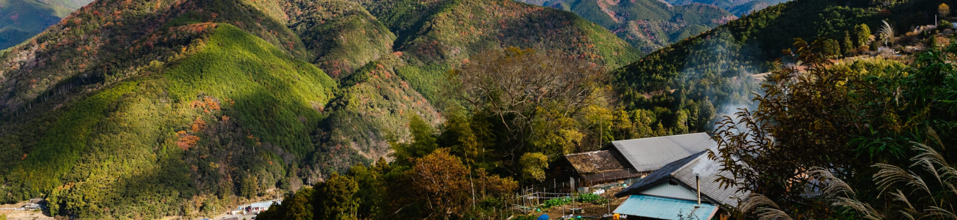
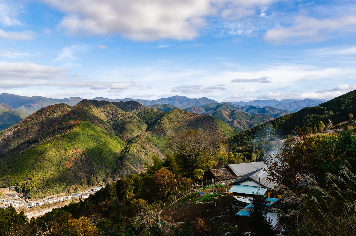
The Kumano Kodo, inscribed on the UNESCO World Heritage list in 2004, is a network of ancient pilgrimage routes in Wakayama Prefecture that lead to the Kumano Sanzan—Kumano Hongu Taisha, Kumano Nachi Taisha, and Kumano Hayatama Taisha. Known collectively as the paths of the Kumano pilgrimage, these sacred trails still draw visitors from across Japan today as a spiritual “power spot” and a place to step away from city life and reconnect with nature.
Along the Kumano Kodo, rivers, waterfalls, and giant rock formations are revered as places where kami (deities) are believed to dwell. Rooted in nature worship, the region is also called a “land of rebirth,” offering spiritual renewal.
In this article, we explain what the Kumano Kodo is, where the routes run, and must-see highlights for first-time visitors.
What is the Kumano Kodo—and where is it?
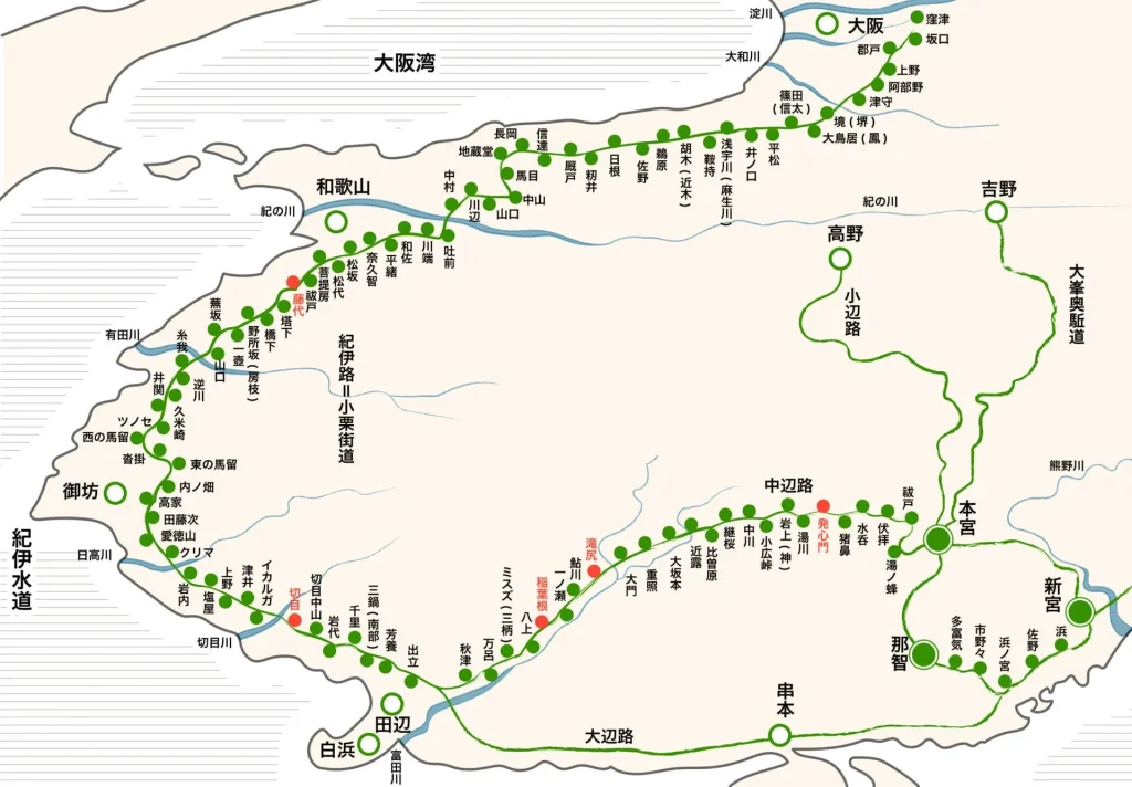
As you can see from the map above, ‘Kumano Kodo’ covers a wide area and has many forks in the road. The total length is said to be 600km. Most parts of the route are in the Wakayama Prefecture, but it is an old route that covers four prefectures including Mie, Nara, and Osaka Prefecture. Kumano Kodo can be divided into 5 main routes. This will be explained in detail later in the article.
The history of Kumano Kodo goes back to the Heian period. For ‘Kumano Moude’ which is the action of visiting the three shrines called “Kumano Sanzan,” the action of walking itself was considered a mountain ascetic practice. Aiming the Kumano Sanzan, people walked regardless of their status, age, and gender. At that time, it was a life-threatening journey that took a month to round trip from Kyoto.
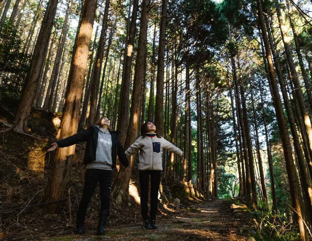
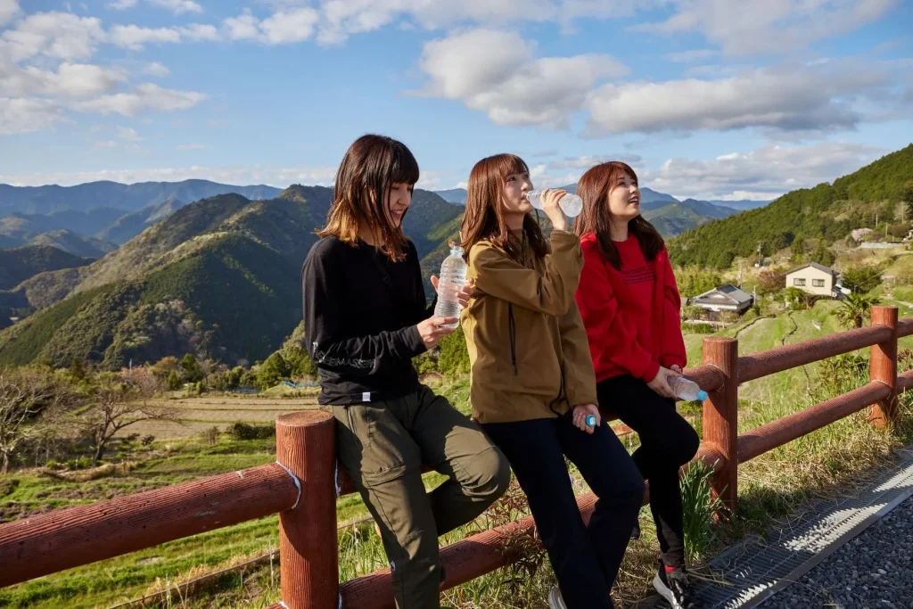
Even today, Kumano Kodo has ancient shrines and nature remaining, which makes it meaningful both historically and as a natural scenery. Since it has been registered as a World Heritage, many people visit from all over Japan and the world. Those who are a beginner at trekking can use the bus or a car to visit tourist spots, and those who are confident in their physical strength can walk the entire route over several days. We also recommend relaxing your tired body in hot springs such as Katsuura Onsen and Yunomine Onsen, which can be found along the Kumano Kodo.
For Kumano Kodo’s history, check this article out for details.
Kumano Sanzan: the spiritual heart of the Kumano Kodo—what it is & the most photogenic spots
We previously described the Kumano Kodo as the network of routes linking the Kumano Sanzan. So what is the Kumano Sanzan?
The Kumano Sanzan refers to the three Grand Shrines—Kumano Hongu Taisha, Kumano Nachi Taisha, and Kumano Hayatama Taisha. The deities of Kumano are rooted in ancient nature worship, and the traditions were originally independent. From the Nara through the Heian periods, however, the doctrine of shinbutsu-shūgō (syncretism of Shinto and Buddhism) spread, and the three shrines came to enshrine a shared pantheon of twelve deities (kami), understood as manifestations of Buddhas. The Kumano Sanzan are the head shrines of a nationwide network of about 4,000 Kumano shrines.
Next, let’s look in detail at each shrine’s location, access, and history.
Kumano Hongu Taisha
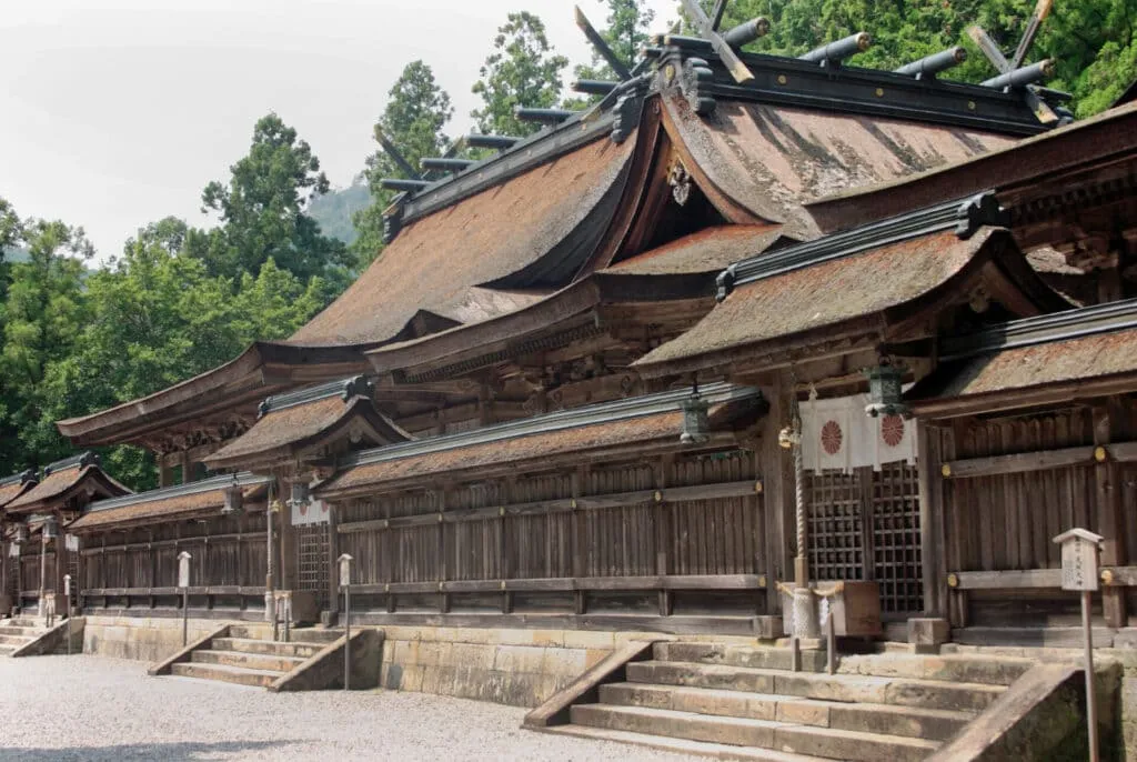
The first site is Kumano Hongu Taisha, the spiritual center of the Kumano pilgrimage. From JR Kii-Tanabe Station it’s about two hours by bus, or roughly 2.5 hours on foot (7 km) from Hosshinmon-oji.
Climb the 158 stone steps to the main sanctuary and you’ll find an austere shrine building with a traditional cypress-bark roof. The area is framed by three rivers—the Kumano, Otonashi, and Yomura—and the views are breathtaking in cherry-blossom and autumn-foliage seasons. At sunrise and sunset, the shrine takes on a different, dreamlike atmosphere.
According to texts such as Kōnendai Ryakki and Jinja Engi, the origins of Hongu Taisha go back to 33 B.C., when a shrine was built at Ōyunohara, a sandbank at the confluence of the three rivers. In the Heian period, members of the imperial family and aristocracy walked the Kumano Kodo from Kyoto—an arduous month-long round trip—to worship here. The principal deity is Susanoo-no-Mikoto. Because Hongu Taisha historically comprised Upper, Middle, and Lower sanctuaries, it is also known as Kumano Sansho Gongen; with its twelve halls enshrining deities, it is likewise called Kumano Junisha Gongen.
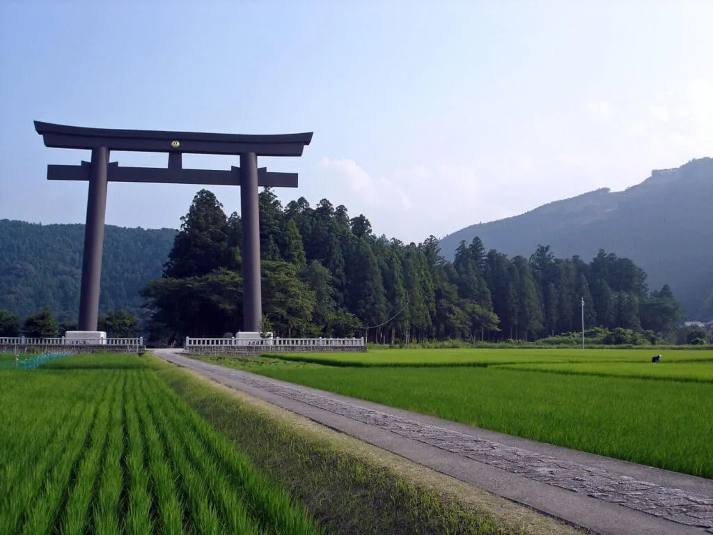
Ōyunohara’s most striking feature is the Great Torii gate—about 34 m tall, the highest in Japan. It stands roughly 500 m from the present main precinct; it’s an easy 10-minute walk, and its sheer scale never fails to impress. In spring, the gate framed by sakura makes a particularly photogenic scene.
In the Meiji era, Hongu’s precinct once included a Noh stage and was about eight times larger than today. A devastating flood in 1889 struck Ōyunohara, and in 1891 the Upper Four sanctuaries were relocated to the current site. Today, Middle Four, Lower Four, and subsidiary shrines remain at Ōyunohara. In the Heisei era, the Kii Peninsula floods again caused severe damage to Ōyunohara and Zuihōden, but by 2014 Zuihōden had been rebuilt, marking a significant step in the area’s recovery.
Official Site
Visiting Hours
8:00~17:00
Admission Fee
Free(For the Treasure Hall Adults: 300 yen Children: 100yen)
Kumano Nachi Taisha
Next is Kumano Nachi Taisha, a shrine near the southern tip of the Kii Peninsula, famed for Nachi Falls. The nearest station is JR Kii-Katsuura; from there it’s about 30 minutes by bus, or you can enjoy a 7.4 km trek from the station.
The shrine complex comprises a Main Hall, Worship Hall, and Treasure Hall. The main sanctuary is arranged with five halls across the front and one to the left. In the precinct stands Miagatahiko-sha, which enshrines Yatagarasu, the three-legged crow who serves the Kumano deities. The Karasu-ishi (“Raven Stone”) on the grounds is said to be Yatagarasu resting in the form of a stone. Many will recognize Yatagarasu from the Japan Football Association emblem.
An approximately 850-year-old camphor tree is revered as a sacred tree. Its hollow trunk forms a short passage for the traditional tainai-kuguri “womb-passing” rite; carrying a goma stick (¥300) or ema plaque (¥500) as you pass through is believed to invite blessings.
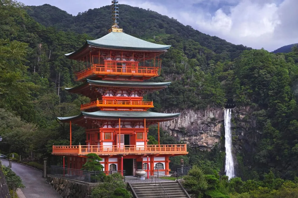
Nachi is home to many waterfalls, but the tallest is Nachi Falls (Nachi no Ōtaki)—also called Ichino-taki—with a height of 133 m, a 13 m mouth, and a plunge pool over 10 m deep; the flow averages about 1 ton per second. The scale is overwhelming. The falls are a symbolic sacred site for Nachi Taisha and were venerated even before the shrine buildings existed.
The waterfall is still believed to confer long life. With a small admission you can approach close to the base and partake of its sacred water. The falls themselves are the deity of Hirō-jinja (Kumano Nachi Taisha Betsugū Hirō-jinja).
Approaching Nachi Taisha, the Daimonzaka is a 1.3 km stone-paved slope lined with ancient trees, including the Meoto-sugi (a paired cedar said to be ~800 years old) and avenues of 300-year-old cedars and camphors. It’s less than an hour on foot from the Daimonzaka entrance to the shrine—an excellent course for Kumano Kodo beginners.
According to legend, in 662 B.C. the party of Kamu-yamato-ihare-biko no Mikoto landed at Nishikiura (today’s Nachi Beach). Guided toward a shining mountain, they discovered Nachi Falls and enshrined it as the shintai (sacred body) of Ōnamuchi-no-kami. In 317 (the 5th year of Emperor Nintoku) a shrine was established midway up the mountain—considered the beginning of Kumano Nachi Taisha. Right next door stands Seiganto-ji Temple, which together with Nachi Taisha forms part of the Kumano Sanzan; visiting both is highly recommended.
OfficOfficial Site
https://kumanonachitaisha.or.jp/
Visitng Hours
8:30~16:30
Admission Fee
Free(For the Treasure Hall Adults: 300 yen)
Kumano Hayatama Taisha
Among the Kumano Sanzan, Kumano Hayatama Taisha is the closest to the sea, standing at the mouth of the Kumano River in Shingū. The nearest station is JR Shingū, and the shrine is within walking distance.
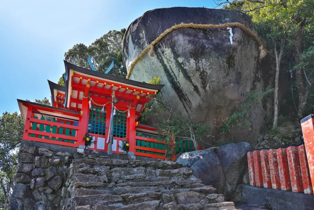
Set against the river, the vivid vermilion buildings enshrine the paired deities Kumano Hayatama-no-Ōkami and Kumano Fusumi-no-Ōkami. According to tradition, during the reign of Emperor Keikō a shrine was established to enshrine the Kumano Gongen who descended upon Gotobiki-iwa at Kamikura Shrine.
Gotobiki-iwa, named from a local word for “toad,” is a colossal boulder—up to eight meters across—reached by 538 stone steps made from natural rocks, an ascent that underscores the site’s sanctity.
Within the precinct stands a 1,000-year-old nagi tree (Nageia nagi), a designated Natural Monument, traditionally said to have been planted by Taira no Shigemori. Owing to the tree’s symmetrical leaves, it is associated with marital harmony. The Kumano Shinpōkan (Museum of Sacred Treasures) displays around 1,200 sacred objects, including maki-e lacquered boxes and cypress fans (hiōgi) from the Muromachi period.
The Gotobiki Iwa is up to eight meters wide and weigh as much as 200 kilograms. Incidentally, Gotobiki is a dialect referring to ‘toad.’ It is said to have been named because it resembles a toad in shape. There are 538 steps up to Gotobiki Iwa, built of natural stones, and you can see its sacredness.。
In addition, there is a giant 1,000-year-old willow tree designated as a natural monument in the precincts. It is a giant tree with a good history and is said to have been planted by Shigemori Tairano. It is said that it has the advantage of harmonious marital relations derived from the symmetrical shape of the leaves. There is also the Kumano Shinpo-kan, where 1,200 sacred treasures are displayed, and you can see Maki-e boxes and cypress hand fans from the Muromachi period.
Official Site
Visiting Hours
Sunrise to sunset (Conferment: 8:00-17:00)
Admission Fee
Free(神宝館は500円)
Why was Kumano Kodo chosen as a World Heritage Site?
In 2004, the “Sacred Sites and Pilgrimage Routes in the Kii Mountain Range”—including the Kumano Kodo—was inscribed on the UNESCO World Heritage List as Japan’s first cultural landscape. UNESCO notes that the sites and their surrounding forest landscape reflect a persistent tradition of sacred mountains, and that the area retains abundant natural features such as mountains, forests, and rivers.
It is often said that only two “pilgrimage routes” are on the World Heritage List—the Kumano Kodo and the Camino de Santiago—but this is outdated. UNESCO has since also inscribed route-based properties such as the Silk Roads: the Routes Network of Chang’an–Tianshan Corridor (2014) and the Qhapaq Ñan/Andean Road System (2014). The Spanish Routes of Santiago de Compostela were first inscribed in 1993 (extended 2015), with the French routes added in 1998.
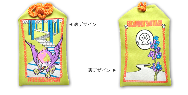
At Kumano Hongu Taisha, you can pick up a special omamori (amulet) created in collaboration with Santiago de Compostela. The design is by Hirohiko Araki, the manga artist behind JoJo’s Bizarre Adventure. A longtime visitor to the Kumano Kodo and Kumano Hongu Taisha, Araki was invited to design the charm through this connection. Imbued with a wish for global “harmony” (wagō), the amulet serves as a timely reminder of the spirit our world needs today.
For the reasons the site was inscribed on the UNESCO World Heritage List, see our separate article.
Which route do we recommend? Five routes connecting the Kumano Sanzan
The Kumano Kodo routes around the Kumano Sanzan are commonly grouped into five main trails. Below are the key features of each.
Choose the route that best matches your fitness level and the scenery you want to enjoy.
Nakahechi(中辺路)
One of the most traveled Kumano Kodo routes, Nakahechi runs about 105 km from Tanabe to Kumano Hongu Taisha, then on to Shingū and Nachi. During the Heian–Kamakura periods, it served as the official imperial pilgrimage route (Kumano gyōkō).
Iseji(伊勢路)
The Iseji links the Ise Grand Shrine to the three Grand Shrines of Kumano. It crosses multiple mountain passes with sweeping views over the Kumano-nada coast and famed terraced rice paddies, offering a constantly changing landscape.
Kohechi(小辺路)
Connecting Mount Kōya (Kōyasan) with Kumano Hongu Taisha, the Kohechi stretches roughly 70 km. Though the most direct line across the range, it’s also the most demanding, crossing several 1,000 m–class passes (e.g., Obako-tōge) and rewarding seasoned trekkers with rugged highland scenery.
Kii-ji / Kiiji(紀伊路)
The Kii-ji (Kiiji) route leads from Jōnangū in Kyoto via Sakai (Osaka) and Kii-Tanabe toward the Kumano shrines. Along the way you’ll encounter historic temples and traditional townscapes; landmarks include preserved residences such as the Former Nakasuji Family Residence.
Ohechi(大辺路)
From Tōkei Jinja in Kii-Tanabe, the Ohechi follows the Pacific coast for about 120 km via Nachikatsuura. Expect classic seaside vistas—glimpses of the ocean through ranks of coastal forest and dramatic headlands unique to this shoreline route.
Beginner-friendly routes on the Kumano Kodo
A first-timer’s pick: Nakahechi—Sangenjaya → Kumano Hongu Taisha
If you’re new to the Kumano Kodo, start with the historic Nakahechi. This gentle 4 km section runs downhill from Sangenjaya-ato (“Old Three Teahouses site”) to Kumano Hongu Taisha, one of the three Grand Shrines of Kumano—manageable even if you’re not confident about your stamina.
Access. From JR Kii-Tanabe Station, take a bus and get off at Hiraiwaguchi. The starting point has a small rest area and toilets modeled after traditional teahouses.
Don’t miss. Make a short detour to the viewpoint along the way. It’s one of Wakayama’s Top 100 Sunset Spots, and on a clear day you can look down on Ōyunohara’s Great Torii—the largest torii gate in Japan.
For more beginner-friendly routes and a packing checklist, see the article below.
Recommended Accommodations along the Kumano Kodo
Along the Kumano Kodo, there are hot spring hotels and guest houses. There are not many, so for those who plan to travel during summer vacation or busy periods, we recommend making reservations early.
Here are recommendations for different types of hot springs and guest houses
Where to stay along the Nakahechi (Kumano Kodo)
Other Articles