8 Must-Visit Geosites Along the Kumano Kodo: Fascinating Geology and Landscapes
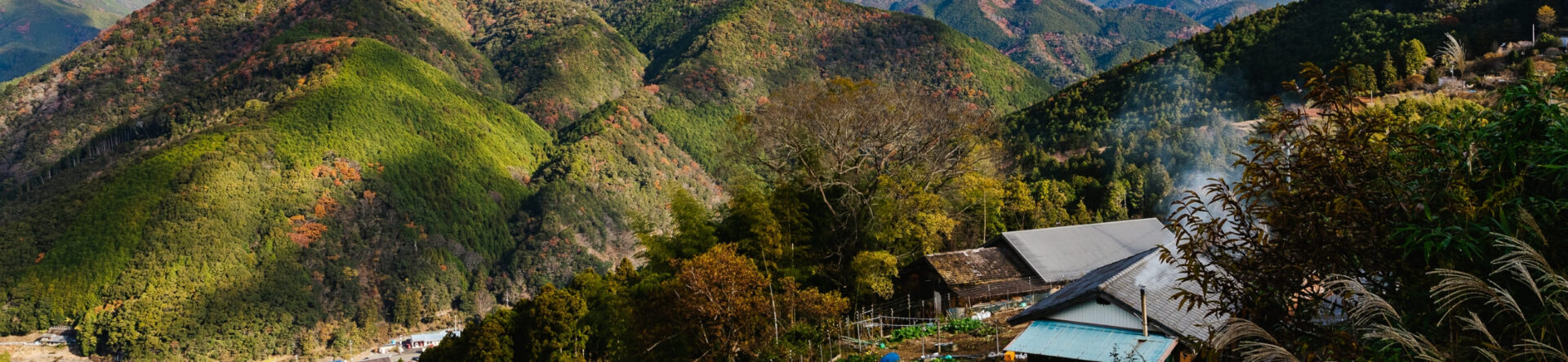
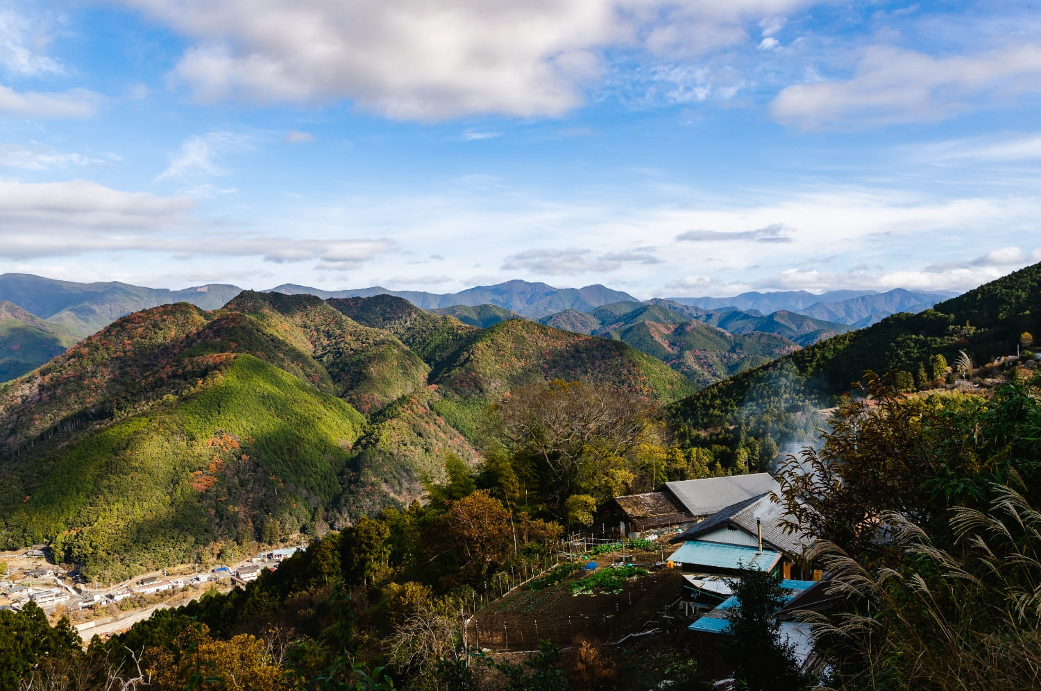
The Kumano Kodo, part of the UNESCO World Heritage–listed Sacred Sites and Pilgrimage Routes in the Kii Mountain Range, is a network of pilgrimage trails that people of all social classes have walked since the Heian period (794–1185) to reach the Kumano Sanzan, the three grand shrines of Kumano. Today it is widely regarded as a spiritual destination and attracts many visitors from overseas.
Geologically, the region is also exceptional. A geopark is a landscape where you can learn about the formation and history of the Earth. The nine municipalities that encompass the Kumano Kodo—Shirahama, Kamitonda, Susami, Kushimoto, Kozagawa, Taiji, Nachikatsuura, Shingū (City), and Kitayama (Village)—together form a vast geopark where you can experience Earth’s history firsthand.
The Geology and Rock Formations of the Kumano Kodo
The geological basement of the Nanki–Kumano region, home to the Kumano Kodo, took shape between about 70 and 20 million years ago. Over the immense span since then, the crust was uplifted, folded, and faulted; volcanic activity fractured the strata, and magma intruded and solidified. Around 2.6 million years ago, these processes gave rise to much of the region’s present-day topography.
As a result, western Kumano offers clear views of folded and faulted strata, while in the eastern areas affected by volcanism you can observe volcanic successions.
Volcanic rocks here include light-colored, coarse-grained intrusive rocks (formed as magma cooled and crystallized) and pyroclastic rocks formed from consolidated volcanic ash and other ejecta.
8 Must-See Geosites to Discover the Geology of the Kumano Kodo
Sites within a geopark are called “geosites.” In this article, we introduce eight of the 107 geosites in the Nanki–Kumano area that are especially worth visiting.
Even if you’ve never been interested in geology before, these spots are fascinating and easy to enjoy. Because many of them are located along the Kumano Kodo pilgrimage route, you can appreciate Kumano’s unique geological features as you trek through its historic paths.
Even repeat visitors to the Kumano Kodo will find a new perspective by viewing familiar landmarks through the lens of geology.
The full list of registered geosites can be found on the official Nanki–Kumano Geopark website.
Nachi Waterfall
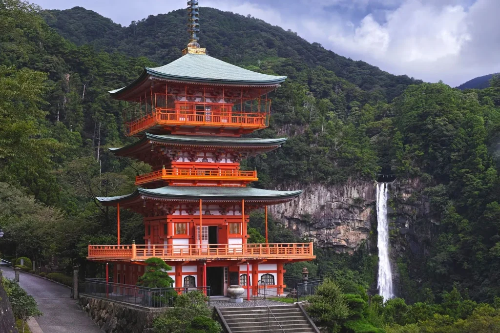
Kumano Nachi Taisha—one of the Three Grand Shrines of Kumano (Kumano Sanzan)—stands in a region famed for its many waterfalls. The tallest among them is Nachi Waterfall (Nachi-no-Taki), also called Ichinotaki (“First Waterfall”). With a 133-meter single drop, it ranks among Japan’s tallest single-drop waterfalls, and its scale is truly breathtaking. Long before the shrine was built, deities were venerated around the falls, which remain a symbolic sacred site of Kumano Nachi Taisha.
Geologically, Nachi Waterfall forms along a boundary between silica-rich rhyolite—created when magma cooled rapidly—and softer surrounding strata. Because rhyolite is highly resistant to erosion, the softer layers wore away more quickly, leaving a resistant rhyolite face; the river now plunges right along this contact, creating the dramatic falls you see today.
For anyone making the Kumano pilgrimage, this is an essential stop—come for the sacred atmosphere, and stay to observe the unusual geology that shaped it.
Map
Gotobiki rock on Mt Kamikura
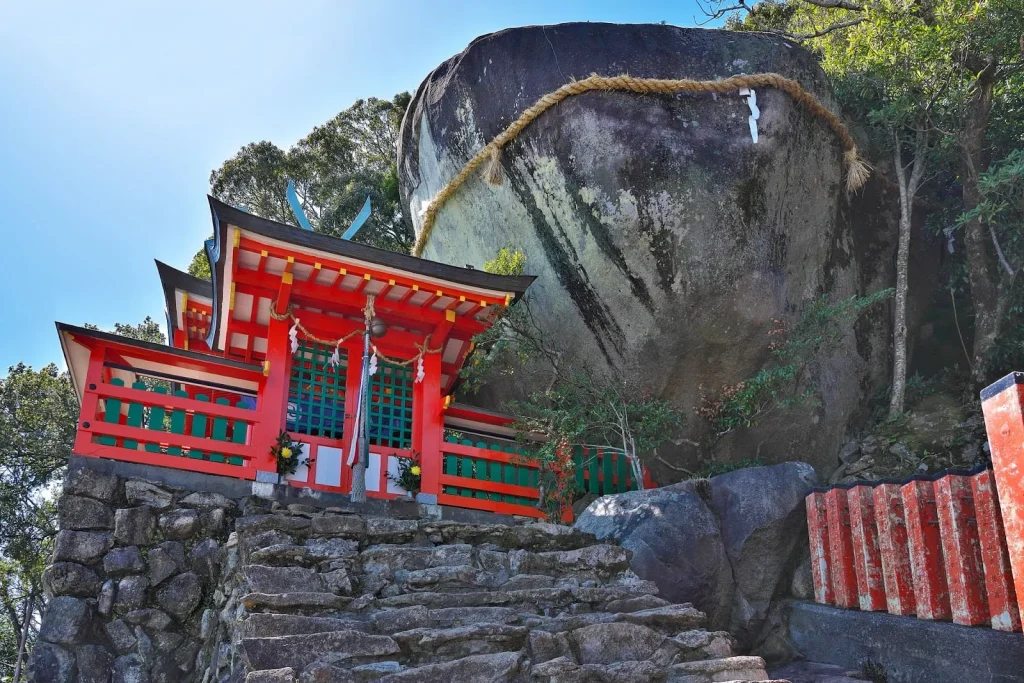
Gotobiki Rock is a massive boulder that suddenly juts out on a mountainside. Its toad-like shape gave it the name “Gotobiki,” meaning “toad” in the local dialect. Remarkably, it is almost spherical—a form that looks anything but man-made. Rocks that weather into near-spherical shapes like this are called corestones, a result of spheroidal weathering.
Like Nachi Waterfall, Gotobiki Iwa formed from the weathering of silica-rich rhyolite belonging to the Kumano Acidic Rocks. It stands about a 17-minute walk from Kumano Hayatama Taisha. According to texts such as the Kumano Gongen engi, the deities of Kumano are said to have descended upon Gotobiki Iwa on Mount Kamikura. A shrine was later established at the current site to enshrine them; the older sanctuary at the rock became the “Motomiya” (original shrine), while the new one was called “Shingū”—literally “new shrine.” In this sense, the area is a cradle of Kumano faith.
Because Gotobiki Rock is clearly visible from the sea, it also served as a landmark for ships.
Kamikura Shrine hosts the famous Oto Matsuri (Oto Festival), a nationally designated Important Intangible Folk Cultural Property. Held every year on February 6, it sees nearly 2,000 men—called agariko—dressed in white with rope belts, charging down the stone steps with flaming torches the moment the gate opens. The spectacle draws crowds of visitors every year.
Map.
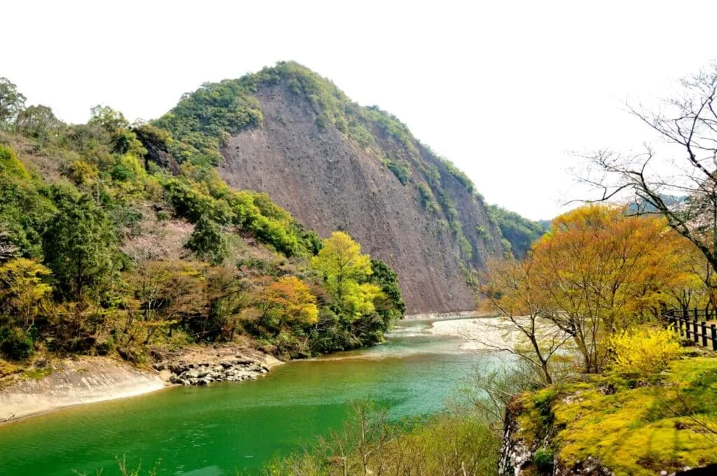
Giant rock at Shimizu Pass
Shimizu Pass (Shimizu-tōge) is an old route that runs along the boundary between Kushimoto and Nachikatsuura. It lies on the Ōhechi Route of the Kumano Kodo. If you scramble up the slope near the entrance on the Kushimoto side, you emerge onto a rounded dike ridge that looks like the back of a giant whale—this is the Giant Rock of Shimizu Pass.
Shimizu Pass follows the Kozagawa Arcuate Dike, selected for Japan’s Top 100 Geological Features. Here you can observe arcuate igneous dikes that curve in a broad arc.
Monoliths of the Kozagawa River
In Kozagawa, you can see a sheer rock wall known as Ichimaiwa (“the One-Slab Rock”)—a breathtaking monolith about 500 meters wide and 100 meters high. Its surface has been smoothed by the flow of the river, giving it a polished look.
The Kozagawa Arcuate Dike, which extends for about 20 kilometers and formed between 15 and 14 million years ago, is thought to have acted as a feeder conduit for magma rising toward the surface. A local folktale known as “Ichimaiwa no Mamoru-inu” (the Guardian Dog of Ichimaiwa) is associated with this cliff; a shadow resembling a giant guardian dog appears twice a year, around April and August.
When you visit Ichimaiwa, take a moment to examine the riverbed pebbles along the Kozagawa River. Because much of the area is volcanic in origin, you can find both light-colored intrusive rocks (formed as magma solidified) and brownish pyroclastic rocks (formed from consolidated volcanic ash and other ejecta).
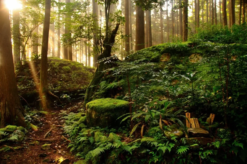
Sukumadani.
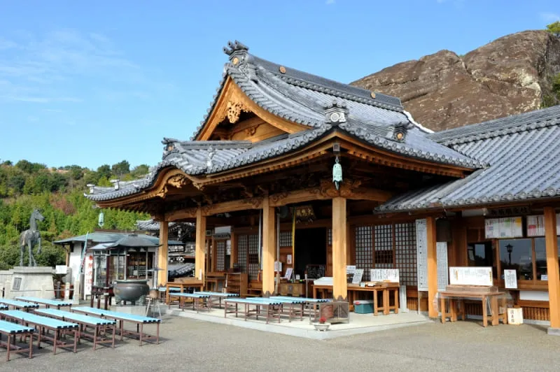
Sukumadani Kannon, the largest Kannon temple for warding off misfortune in the Kinan region, is notable for a shrine complex built against a monolithic rock outcrop, appearing almost fused with the stone.
Here, thick sandstone–conglomerate beds (basal conglomerates) resist weathering and erosion, creating steep cliffs atop which Sukumadani Kannon stands. The site also exposes an accretionary complex—a geological structure formed at a subduction zone where an oceanic plate is driven beneath a continental plate.
Mudstone Mountains of Shirahama
The “Shirahama Mudstone Dikes” are a nationally designated Natural Monument (Japan). Earlier-deposited mud-rich layers liquefied under the load of overlying strata and were injected upward through fractures in the overlying beds, rising several hundred meters.
As a result, you can observe striking mudstone clastic dikes—sometimes forming ridges at the surface. Shirahama is one of the few places where multiple mudstone dike systems can be seen in close proximity.
Phoenix Fold (Phoenix Cliffs).
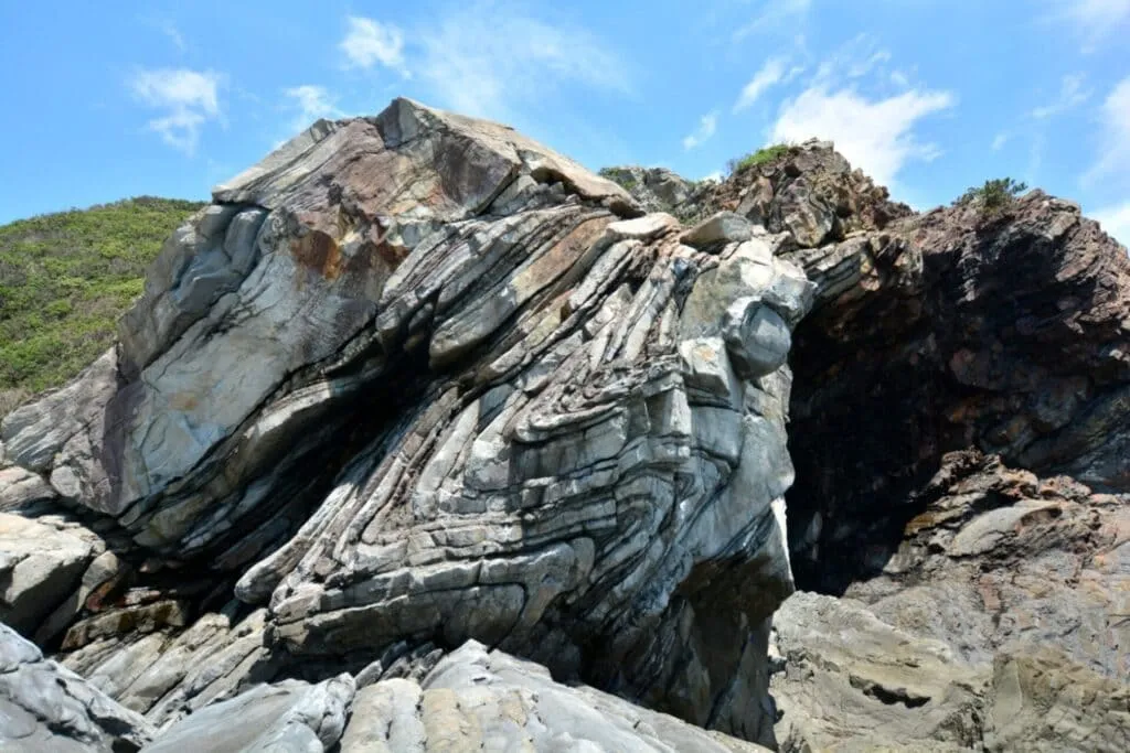
“Folding” records traces of ancient crustal deformation. The Phoenix Fold(s) are thought to have formed during tectonic events 20–40 million years ago, and their sheer scale has earned them mentions in international geology literature and science textbooks.
Here, sandstone layers were pushed landward and folded before they fully lithified, producing spectacular structures. You can observe Z-shaped and V-shaped (chevron-like) folds in the strata.
The site involves exposed, hazardous terrain, so sturdy hiking boots are essential. The Nanki-Kumano Geopark Center also offers guided tours—highly recommended for first-time visitors.
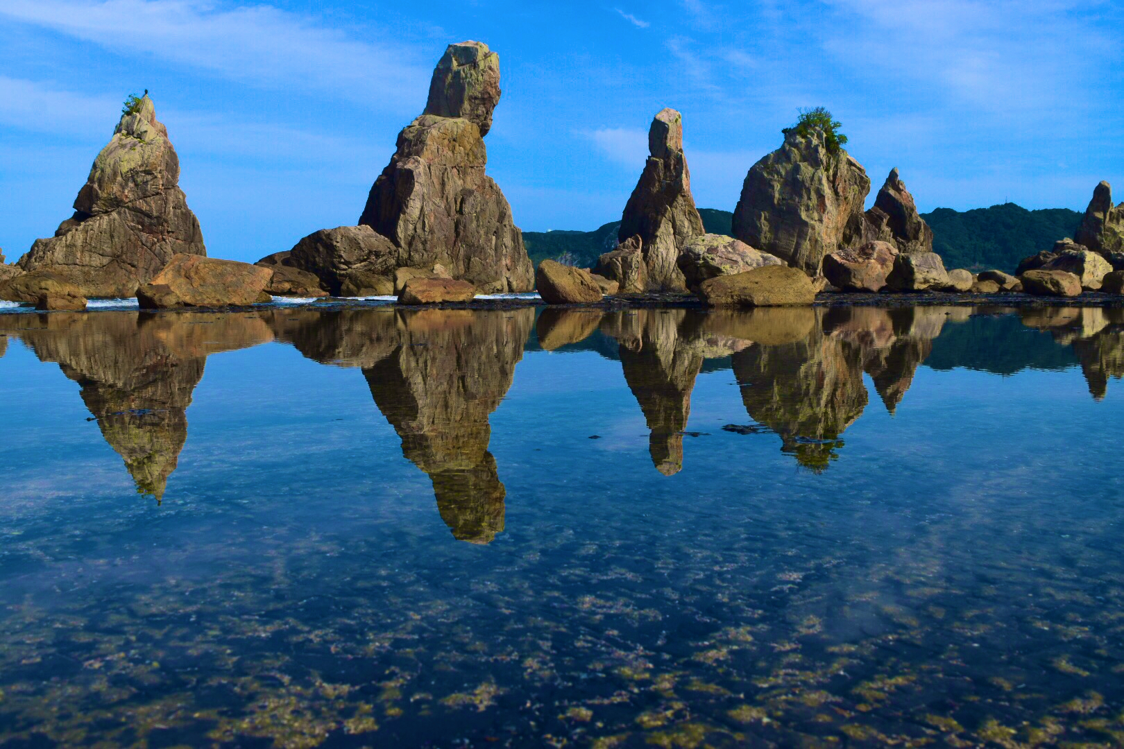
Hashigui-iwa (Bridge Pile Rock)
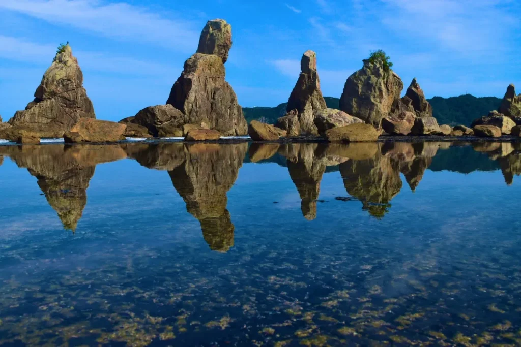
Hashigui-iwa is a line of rock pillars about 15 meters wide and roughly 900 meters long. These pillars formed 15–14 million years ago when magma intruded into the sedimentary strata of the Kumano Group, later being sculpted by erosion.
Because the boulders become smaller with increasing distance from Hashigui-iwa, researchers infer that many were carried away by a large tsunami, and studies use these deposits to estimate past tsunami magnitudes.
Beyond its geological interest, Hashigui-iwa is tied to local folklore—stories of Kōbō Daishi (Kūkai) and an Amanojaku, as well as the Honest Man and an Umibōzu—and it is also a breeding site for the Uchiyama-sennyū (Pleske’s grasshopper warbler), a very rare bird. There is plenty to enjoy here beyond geology.
Other Articles