Kumano Kodo Highlights: A Complete Itinerary to Must-See Spots
The Kumano Kodo is one of only two pilgrimage route networks in the world inscribed as a UNESCO World Heritage Site. Spanning Wakayama, Mie, Nara, and Osaka Prefectures, it stretches roughly 600 km and offers a rich variety of routes and sights. For travelers, choosing where to go—and which path to take—can feel daunting.
In this article, we share a recommended trekking itinerary that links some of the very best highlights along the Kumano Kodo.
Three Recommended Kumano Kodo Trekking Routes.
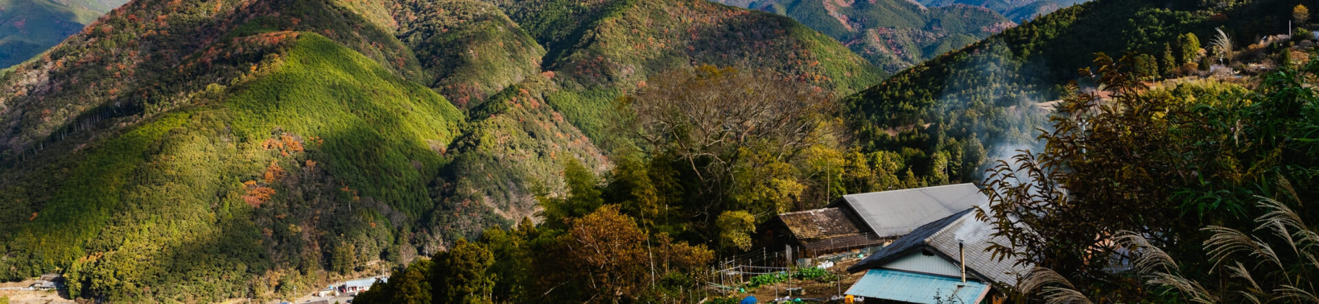
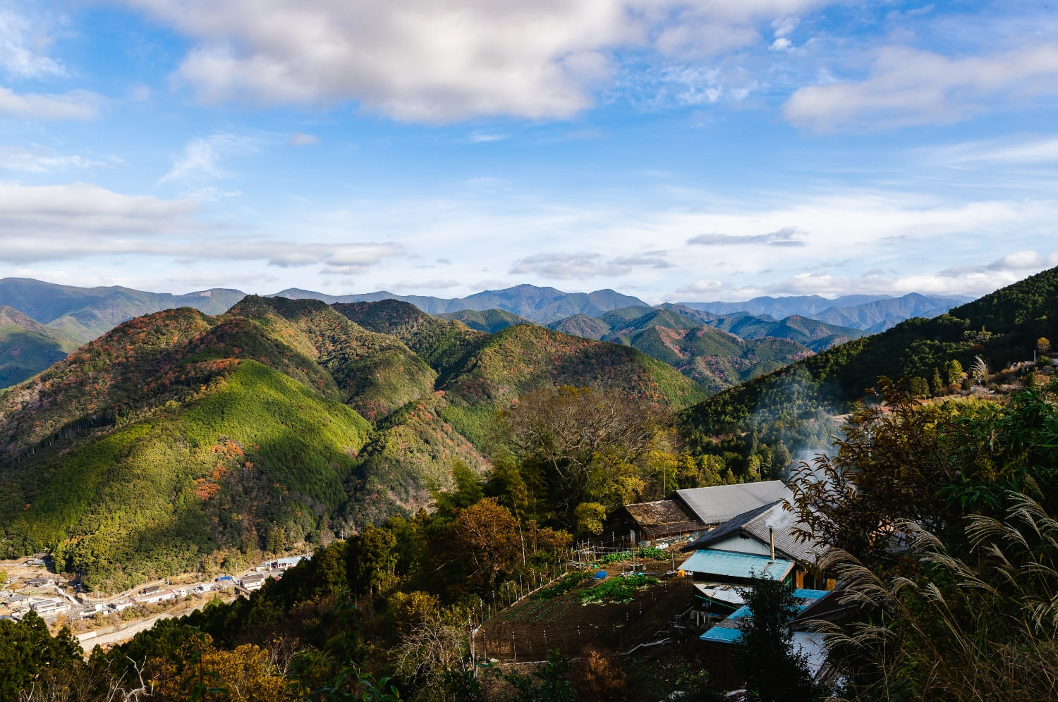
The Kumano Kodo centers on the Kumano Sanzan—three grand Shinto shrines that have drawn pilgrims since ancient times.
Around these shrines, the network offers a wide range of routes: gentle, flat sections; trails with steep climbs; coastal stretches with sea views; and historically significant paths.
Experience the Historic Kumano Kodo: From Koyasan to Kumano Hongu Taisha (Grand Shrine)
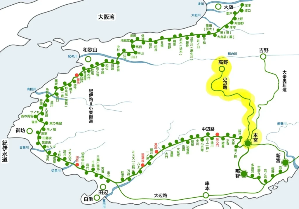
The Kumano Kodo has five principal pilgrimage routes; among them, the Kohechi links Koyasan with Kumano Hongu Taisha, one of the three grand shrines known collectively as the Kumano Sanzan.
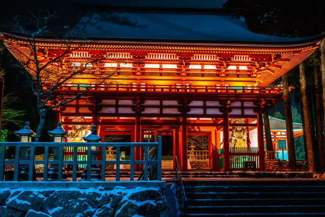
Koyasan was founded by Kobo Daishi (Kukai) in the early Heian period (794–1185). While Kongobu-ji is its best-known temple, Koyasan functions as a vast temple complex that encompasses the entire mountaintop. In this article, we start from Koyasan, follow the Kohechi trail, and make our way to Kumano Hongu Taisha.
We break the journey from Koyasan to Kumano Hongu Taisha into three sections. For day-trippers or those unsure about their fitness, we recommend walking only the first segment, the Koyasan–Mizugamine route.
Koyasan – Mizugamine (Omata) route
The Kohechi is the shortest route linking Koyasan and Kumano Hongu Taisha—one of the three grand shrines of the Kumano Sanzan—but because it traverses a chain of 1,000-meter peaks, it’s also a demanding trail.
That said, the Koyasan → Mizugamine segment is comparatively gentle with minimal elevation change—an excellent choice if you want to walk at an easy pace while soaking up the area’s history.
To deepen the cultural experience, consider staying the night on Koyasan beforehand. There are 50+ shukubō (temple lodgings) where you can enjoy shōjin ryōri (Buddhist vegetarian cuisine) and stroll through vividly landscaped temple gardens; some even have onsen (hot-spring baths).
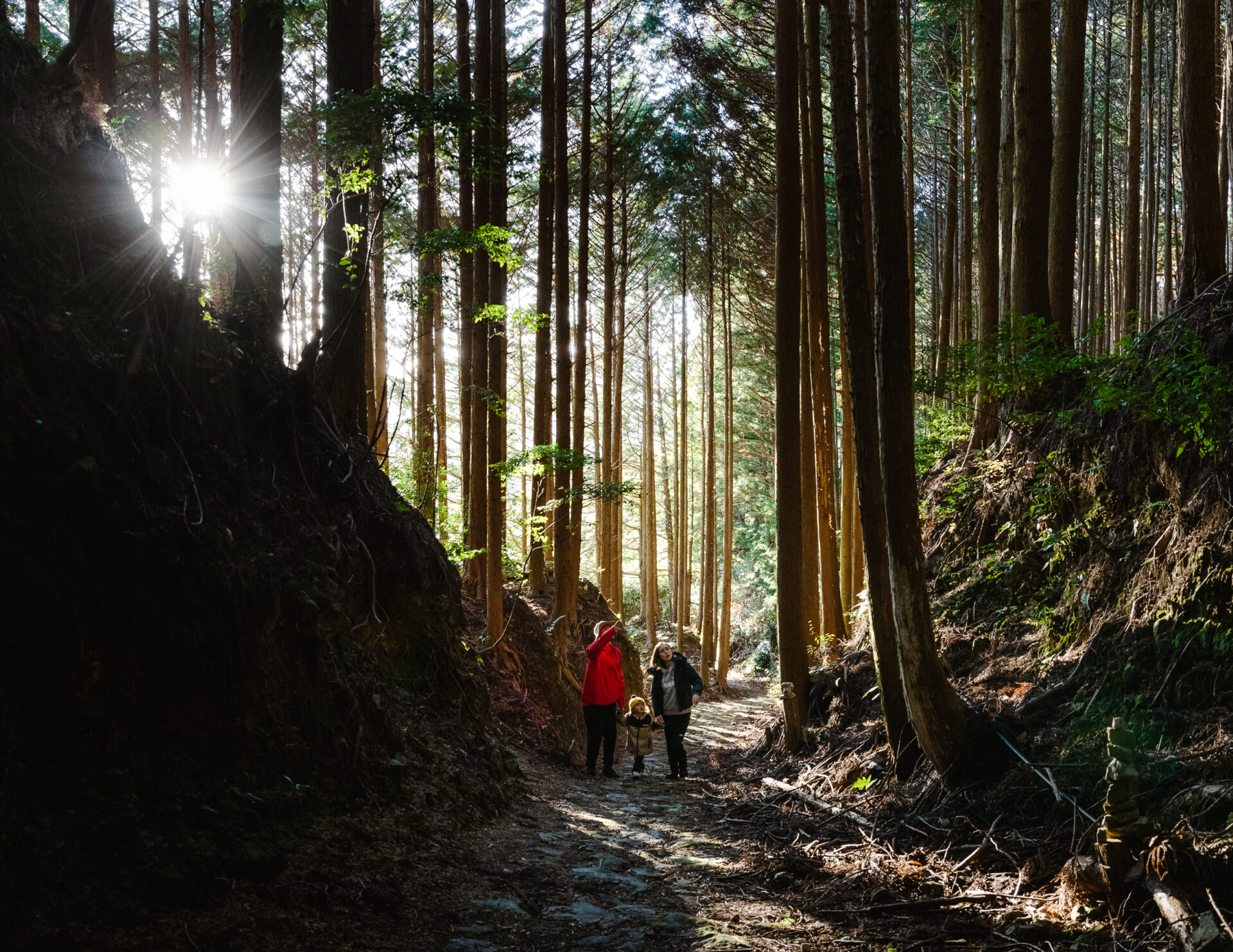
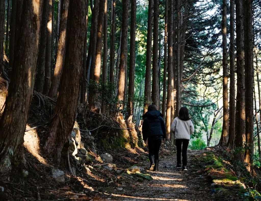
On the following day, set out from Koyasan toward Rokuro-tōge (Rokuro Pass). Just nearby is the Otakiguchi Nyonin-dō Site (the former “women’s hall”), which is worth a brief stop. The ascent is gentle up to this point.
Continue about 2 km on an easy grade to Susuki-tōge (Susuki Pass), after which a mild descent leads to the Ōtaki hamlet in roughly 1.5 hours. Pass through the cluster of homes and re-enter the mountain path.
From here the trail climbs again. There are rest spots along the way—pace yourself. You’ll merge with the Kōya-Ryūjin Skyline mountain road; watch for traffic at the crossing.
Your goal is the area in front of the Nosegawa Village Information Center. From here, take a bus back—around 35 minutes to Koyasan via the Nankai Rinkan Bus.
Duration.
Approx. 4.5 hours
Distance.
Approx. 11.3 km
Difficulty level
★★☆☆☆
Mizugamine – Miuraguchi – Yanagimoto Bridge
From here, the Kohechi trail crosses two mountain passes rising over 1,000 meters—Obako-tōge (Obako Pass) and Miura-tōge (Miura Pass)—before descending toward Totsukawa Onsen.
The entire journey takes about 17.5 hours on foot and usually requires three days and two nights from Koyasan. Though demanding, it’s an ideal route for immersing yourself in untouched mountain nature.
Why not retrace the footsteps of the yamabushi, the mountain ascetics who once trained along these sacred paths?
From Mizugamine, follow the Kohechi waymarks toward “Ōmata,” entering a forest path that descends gently for about 1 hour and 20 minutes to the Ōmata bus stop.
From there, begin the ascent toward the summit of Mt. Obako.
Beyond this point, the trail narrows and can be prone to small landslides—take care. You’ll pass the seated statue of Kōbō Daishi, the Mizugamoto Teahouse ruins, and the Machihira Residence site, before reaching the Mt. Obako trailhead. From there, it’s about a 15-minute walk to Miura-guchi, a good place to stay overnight on the second day.
On the third day, climb again to Miura-tōge (Miura Pass). On the descent, you’ll find scenic viewpoints overlooking mountain villages below.
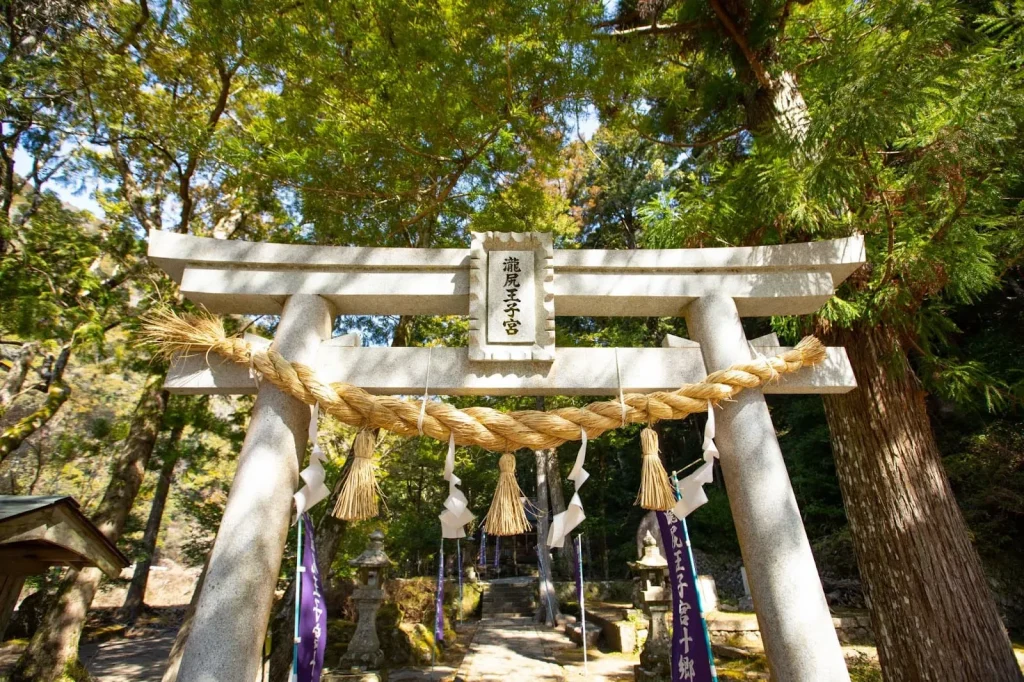
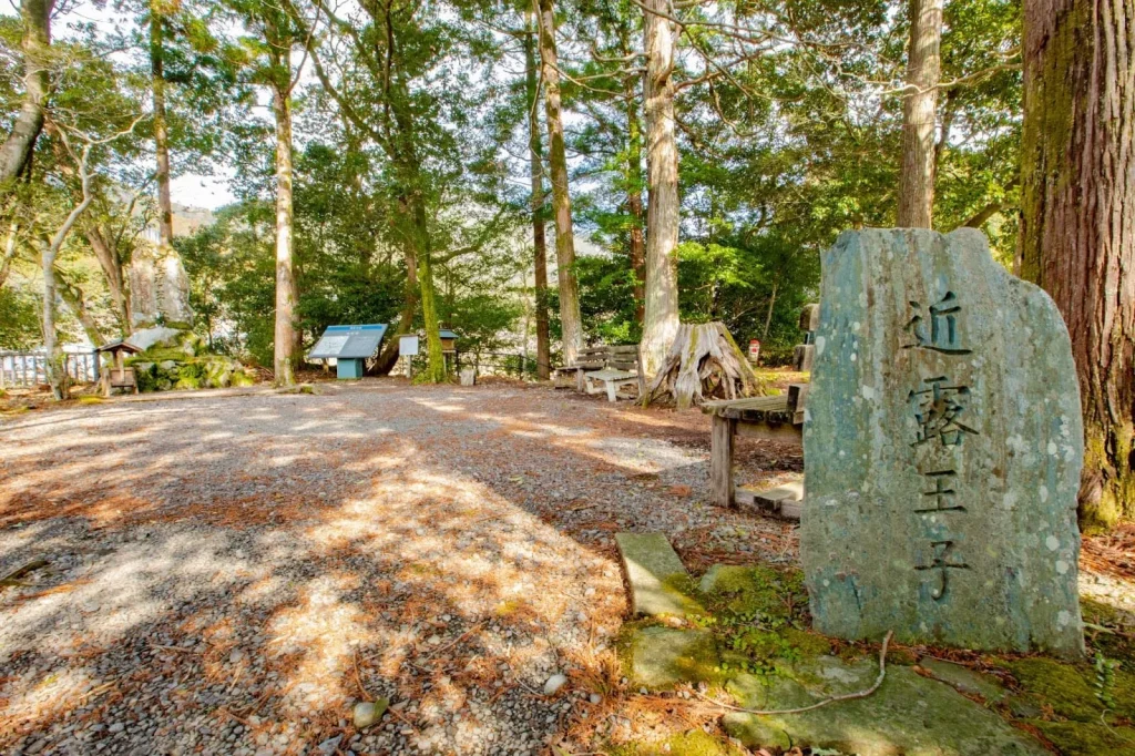
Continue past Yakura Kannondō, Kawai Shrine, and the Fukuda-dera ruins to reach Ōtsugoe Daishidō.
From here, it’s about 20 minutes to the finishing point at Yanagimoto Bridge.
From Yanagimoto Bridge, it’s a 10–30-minute walk to Totsukawa Onsen (Nara Prefecture)—the perfect place to relax in a hot spring after your long trek.
Time taken.
Approx. 17.5 hours
Distance
Approx. 43 km
Difficulty level
★★★★★
Totsukawa Onsen → Kumano Hongu Taisha (via Hatenashi Pass)
From Totsukawa Onsen, set out toward Kumano Hongu Taisha, one of the three grand shrines of the Kumano Sanzan.
This section of the Kohechi route is a challenging one, as it climbs over Hatenashi-tōge (Hatenashi Pass) at an elevation of just over 1,000 meters.
Leaving Totsukawa Onsen, the trail ascends steadily. Passing through the Hatenashi Hamlet and Kannondō Hall, you’ll reach Hatenashi Pass in about two hours.
Along the way are several fine viewpoints—take time to enjoy the sweeping mountain scenery.
From the pass, the trail descends. You’ll notice rows of stone Kannon statues built by local residents at the end of the Taishō era (1912–1926) lining the roadside.
Descending to Nanairo-tsuji, you’ll cross from Nara Prefecture into Wakayama Prefecture.
Take a short rest at Michi-no-Eki Okukumano-Kodo Hongu (Roadside Station Okukumano Kodo Hongu), then continue on to the Sangenjaya ruins—the goal is just ahead!
After visiting Kumano Hongu Taisha, don’t miss the massive Ōyunohara Torii, Japan’s largest shrine gate, located just a 10-minute walk away.
Time taken.
Approx. 7.5 hours
Distance.
Approx. 15.2 km
Difficulty.
★★★★☆
I am confident in my fitness! Recommended for those who are confident in their fitness!
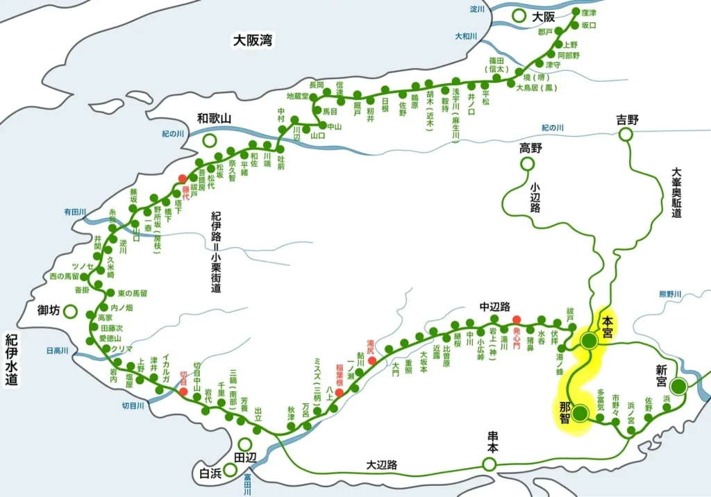
This route over the Kogumotori-goe and Ogumotori-goe passes is recommended for advanced hikers and anyone confident in their fitness. It links Kumano Nachi Taisha to Kumano Hongu Taisha.
As their names suggest—literally “crossing the clouds”—Kogumotori-goe and Ogumotori-goe traverse high ridgelines. In particular, Ogumotori-goe involves multiple climbs over peaks around 800 meters.
After paying your respects at Kumano Nachi Taisha, start walking from Nachi Kōgen Park. Take care on the steep descent near Irokawa-tsuji. To cross Ishikura-tōge and Echizen-tōge, you’ll tackle a mix of steep climbs and descents. Once you reach Echizen-tōge, take a breather.
From Echizen-tōge, it’s about two hours to Koguchi, your lodging area for night one. There are several guesthouses in Koguchi, but they often fill up—book early.
Day 2: From Koguchi, take on Kogumotori-goe. Compared with Ogumotori-goe, this section is gentler and makes for a very pleasant hike. It’s about one hour to Sakura-tōge; from there, a gradual descent continues, and after the Hyakken-gura viewpoint the trail follows an easy-to-walk ridgeline. From Ukegawa Bus Stop, it’s roughly a 40-minute walk to Kumano Hongu Taisha, so you’ll have ample time for an unhurried visit on day two.
Time required
Approx. 7 hours (Oyumo-taketsu) + Approx. 5.5 hours (Koyumo-taketsu)
Distance
Approx. 14.5km (Oyun-Taketsu) + Approx. 13km (Kobun-Taketsu)
Difficulty
★★★★★
For spectacular views! | TakijiriOji – ChikatsuyuOji.
Lastly, we recommend the scenic “Takijiri-oji → Chikatsuyu-oji” section—famous for its chance of a sea of clouds.
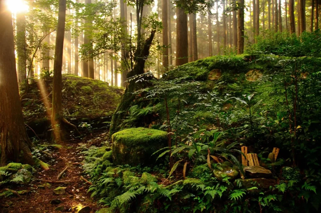
Takijiri-oji, located at the confluence of the Tonda-gawa and Ishibune-gawa rivers, was historically regarded as the gateway to the sacred realm of the Kumano Sanzan. A steep climb greets you right after the start, but it’s early in the day and manageable. Along this initial ascent you’ll pass four highlights: Tainai-kuguri (a “womb-passing” rock tunnel), Chichi-iwa (“Breast Rock”), …-oji (不寝王子), and the Mt. Ken-no-san Sutra-mound remains.
Once past this point, you’ll reach the first scenic lookout—perfect for a short rest while you take in the view.
From the Ken-no-san Sutra-mound site, the trail becomes gentler with flat sections and steps, making for easy walking. In just under an hour you’ll arrive at Takahara Kumano Shrine. Its shrine buildings are said to be the oldest along the Nakahechi route, and records note a visit by Fujiwara no Teika. Take a moment to soak in the history.
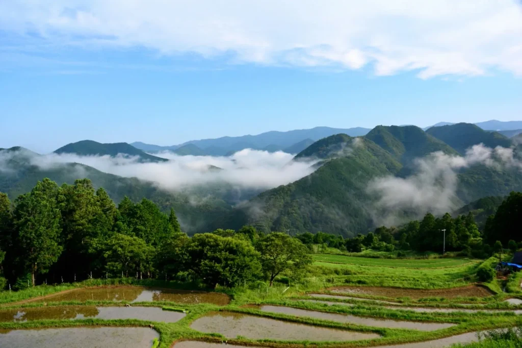
Continue on to Takahara Kiri-no-Sato (“Fog Village”)—a famed sea-of-clouds viewpoint. The prime season is autumn through winter. Aim for early morning (within about an hour after sunrise) when the day–night temperature gap is large, humidity is high, and winds are calm. Even during the day, the panoramas are outstanding.
Don’t miss the scenic viewpoints between Daimon-oji and Jūjō-oji.
From there, you’ll cross three mountain passes—Jūjō-tōge, Ōsaka-tōge, and Hashiori-tōge—and after passing the Gyūba Dōji statue, you’ll arrive in the Chikatsuyu village area.
The Gyūba Dōji is a small stone statue, about 50 cm tall, depicting a monk riding both an ox and a horse. It’s charmingly small—so keep your eyes peeled and don’t miss it!
The view across the village of Chikatsuyu evokes the charm of rural Japan. In April 2022, a new stay—SEN.RETREAT CHIKATSUYU—opened here. It’s a container-villa built from repurposed containers, complete with a private garden and a rooftop terrace. After a long day on the trail, it’s a great place to unwind.
Duration.
Approx. 6.5 hours
Distance
Approx. 13 km
Difficulty level
★★★☆☆
[Extra] Recommended for beginners: a course that can be walked in three hours.
Want to walk the Kumano Kodo but not confident about your fitness?
We recommend a beginner-friendly highlights route that lets you sample the best sections of the Kumano Kodo. It’s also perfect if your trekking time is limited—ideal for a 1–2 day (one-night) trip.
Other Articles